Add Pathway Analysis Group
Pathway analysis is mainly used to analyze the people counting on the pathways in the shopping malls. With the help of fisheye cameras, the system can collect the consumers data (for example,where the customers walk mostly) and translate that data onto a dashboard for mall managers. This helps managers analyze which areas/shops of the mall best catch a shopper's attention and which are overlooked. After setting the fisheye camera's pathways and their directions, the system calculates the people dwell time at each pathway and number of people walking by, thus helps them make decisions.
This function is only supported by the second generation of fisheye cameras. You should have configured intersection analysis rule for the fisheye camera. If not, click Configuration to set that on the remote configuration page of the device.
-
In the top left corner of the platform, select
 > Intelligent Analysis > Analysis Group > Pathway Analysis Group.
- Optional:
Locate the pathway analysis group on the map by setting the locations of the
fisheye cameras in the group and setting the directions for camera's
exits.
Note:
To define the camera's exits, refer to the user manual of the camera.
-
Perform the above sub-steps to draw other pathways.
Note:
You can also draw a line to link the exits of two fisheye cameras if there are two cameras in the pathway.
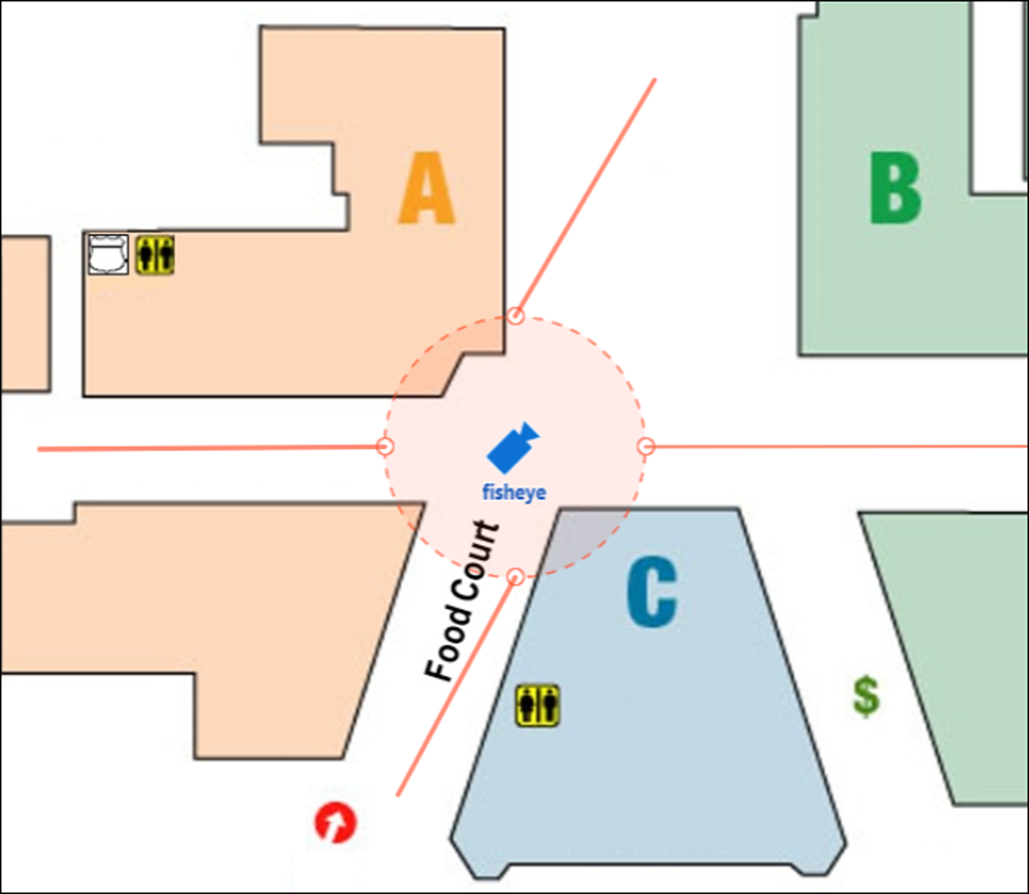 Figure 1 Add Pathway
Analysis Group
Figure 1 Add Pathway
Analysis Group
After adding the pathway analysis group on the map, you can view the real-time number of people walking by on the Control Client.
-
Perform the above sub-steps to draw other pathways.